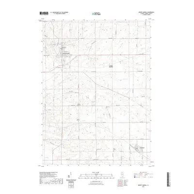
2021 Map of Mount Carroll
USGS Topo · Published 2021About this map
The Carroll County Courthouse stands as a central landmark in Mount Carroll, a town characterized by a dense grid of streets like W Commercial St and S Main St. This 2021 survey illustrates the rural landscape of Northwest Illinois, where the terrain is carved by the winding paths of Carroll Cr and Johnson Cr. The map highlights a significant genealogical record through numerous burial sites dispersed across the countryside, including Oak Hill Cem, Oakville Cem, and the Adams-Daggert Cem. To the southeast, the village of Chadwick marks a secondary hub of settlement. The geography is further defined by the intersection of rail and road at Ashdale Junction and the recreational waters of Timber Lake, reflecting a long-standing balance between agricultural land use and small-town infrastructure.
Find a feature on this map
67 named features on this map. Tap any name to fly to it.
Don’t see what you’re looking for? This feature index may not catch every label — zoom into the map to look around manually.
Map Details
Editions of this 2021 Mount Carroll Map
This is the sole edition of this map. No revisions or reprints were ever made.
Other maps of this area

1891 · Clinton
USGS Topo · 1:62,500

1892 · Savanna
USGS Topo · 1:62,500

1894 · Clinton
USGS Topo · 1:62,500

1899 · Clinton
USGS Topo · 1:125,000

1934 · Morrison
USGS Topo · 1:48,000

1940 · Morrison
USGS Topo · 1:62,500

1942 · Mt Carroll
USGS Topo · 1:62,500

1944 · Mt Carroll
USGS Topo · 1:62,500

1952 · Clinton
USGS Topo · 1:62,500

1952 · Savanna
USGS Topo · 1:62,500