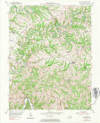
1954 Map of Mount Eden
USGS Topo · Published 1984About this map
Mount Eden sits at the intersection of local routes in a landscape defined by the deep incisions of the Salt River and its numerous tributaries. Surveyed in the early 1950s, this area on the border of Shelby and Spencer Counties shows a decentralized rural settlement pattern typical of the Kentucky bluegrass-knobs fringe. Small crossroads communities and family-named ridges serve as the primary landmarks, with social life centered around institutions like Salem Ch, Bethlehem Ch, and Upper Brier Ridge Ch.
Find a feature on this map
27 named features on this map. Tap any name to fly to it.
Don’t see what you’re looking for? This feature index may not catch every label — zoom into the map to look around manually.
Map Details
Editions of this 1954 Mount Eden Map
4 editions found
Other maps of this area

1923 · Waddy
USGS Topo · 1:48,000

1925 · Mount Eden
USGS Topo · 1:48,000

1927 · Mount Eden
USGS Topo · 1:62,500

1929 · Taylorsville
USGS Topo · 1:62,500

1952 · Ashbrook
USGS Topo · 1:24,000

1952 · Chaplin
USGS Topo · 1:24,000

1953 · Bloomfield
USGS Topo · 1:24,000
1954 · Glensboro
USGS Topo · 1:24,000

1954 · Taylorsville
USGS Topo · 1:24,000
1954 · Waddy
USGS Topo · 1:24,000