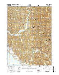
2017 Map of Mount Emily
USGS Topo · Published 2017About this map
The Chetco River and Winchuck River dominate this coastal landscape, where the Siskiyou mountains meet the Pacific. The settlement of Harbor serves as the primary hub, situated near the mouth of the Winchuck, while the interior is defined by steep terrain features like Gardner Ridge and the prominent Mt Emily. This area preserves significant local history through the Pioneer Cem and Van Pelt Cem, markers of early family settlement along the coast.
Find a feature on this map
89 named features on this map. Tap any name to fly to it.
Don’t see what you’re looking for? This feature index may not catch every label — zoom into the map to look around manually.
Map Details
Editions of this 2017 Mount Emily Map
This is the sole edition of this map. No revisions or reprints were ever made.
Other maps of this area

1929 · Crescent City
USGS Topo · 1:125,000

1945 · Point St. George
USGS Topo · 1:62,500

1949 · Eureka
USGS Topo · 1:250,000

1952 · Crescent City
USGS Topo · 1:62,500

1954 · Coos Bay
USGS Topo · 1:250,000

1954 · Cape Ferrelo
USGS Topo · 1:62,500

1954 · Mt. Emily
USGS Topo · 1:62,500

1956 · Smith River
USGS Topo · 1:24,000

1958 · Eureka
USGS Topo · 1:250,000

1958 · Coos Bay
USGS Topo · 1:250,000