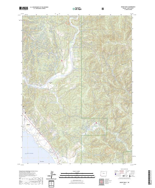
2024 Map of Mount Emily
USGS Topo · Published 2024About this map
Harbor serves as the primary coastal settlement on this recent study of the southern Oregon coast, where the Chetco River meets the Pacific Ocean. The landscape transitions from the shoreline, protected by the Oregon Islands National Wildlife Refuge, into the dense timberlands of the Siskiyou National Forest. Local history is anchored at the Pioneer Cemetery and Van Pelt Cemetery, while the interior terrain is defined by dramatic ridgelines such as Boar Backbone, Wheeler Ridge, and the prominent Mt Emily. The drainage system is intricate, with the Winchuck River winding through the southern portion of the map near Peavine Ridge. Settlement patterns follow the river valleys and coastal benches, with named locations like Ostenbery Bar tucked along the river bends. The presence of the Oregon Redwoods Hiking Trail highlights the unique botanical character of this corner of Curry County.
Find a feature on this map
80 named features on this map. Tap any name to fly to it.
Don’t see what you’re looking for? This feature index may not catch every label — zoom into the map to look around manually.
Map Details
Editions of this 2024 Mount Emily Map
This is the sole edition of this map. No revisions or reprints were ever made.
Other maps of this area

1929 · Crescent City
USGS Topo · 1:125,000

1945 · Point St. George
USGS Topo · 1:62,500

1949 · Eureka
USGS Topo · 1:250,000

1952 · Crescent City
USGS Topo · 1:62,500

1954 · Coos Bay
USGS Topo · 1:250,000

1954 · Cape Ferrelo
USGS Topo · 1:62,500

1954 · Mt. Emily
USGS Topo · 1:62,500

1956 · Smith River
USGS Topo · 1:24,000

1958 · Eureka
USGS Topo · 1:250,000

1958 · Coos Bay
USGS Topo · 1:250,000