
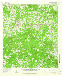
1960 Map of Mount Enterprise
USGS Topo · Published 1962About this map
The town of Mount Enterprise serves as a central hub for this rural stretch of East Texas, where the landscape is defined by the headwaters of the Angelina River and numerous winding branches. By the early 1960s, the region maintained a pattern of small settlements and dispersed country churches like Shiloh Ch and Isabell Chapel, often accompanied by family or community burial grounds such as Whitfield Cem and Helpenstell Cem. The presence of several youth organizations is notable, including Camp Tonkawa and Whispering Pines, utilizing the wooded terrain between the Rusk and Nacogdoches county line.
Find a feature on this map
97 named features on this map. Tap any name to fly to it.
Don’t see what you’re looking for? This feature index may not catch every label — zoom into the map to look around manually.
Map Details
Editions of this 1960 Mount Enterprise Map
2 editions found
Other maps of this area

1935 · Henderson
USGS Topo · 1:48,000

1939 · Henderson
USGS Topo · 1:62,500

1943 · Cushing
USGS Topo · 1:62,500

1945 · Cushing
USGS Topo · 1:62,500

1952 · Douglass
USGS Topo · 1:62,500

1952 · Nacogdoches
USGS Topo · 1:62,500

1953 · Palestine
USGS Topo · 1:250,000

1956 · Tyler
USGS Topo · 1:250,000

1957 · Palestine
USGS Topo · 1:250,000

1958 · Martinsville
USGS Topo · 1:62,500