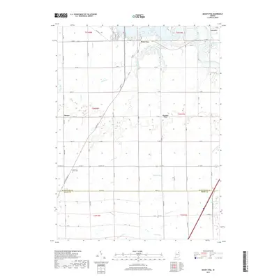
2019 Map of Mount Etna
USGS Topo · Published 2019About this map
Mount Etna and its surrounding rural landscapes are defined by the convergence of the Salamonie River and the significant reach of Salamonie Lake. This 2019 survey captures the highly structured agricultural grid of north-central Indiana, where the border between Huntington County and Grant County runs through a territory of small settlements and family burial grounds. Local history is anchored at sites like Purviance Cem and Lee Cem, while the modern landscape is shaped by extensive drainage systems including Detamore Ditch and Buck Run Ditch. Small communities such as Banquo, Lancaster, and Pleasant Plain remain as central points within the vast network of county roads, connected by watercourses like Richland Cr and Prairie Cr. The map illustrates how late-20th-century water management and traditional agrarian patterns continue to coexist in this region.
Find a feature on this map
65 named features on this map. Tap any name to fly to it.
Don’t see what you’re looking for? This feature index may not catch every label — zoom into the map to look around manually.
Map Details
Editions of this 2019 Mount Etna Map
This is the sole edition of this map. No revisions or reprints were ever made.
Other maps of this area

1950 · Lagro
USGS Topo · 1:24,000

1950 · Andrews
USGS Topo · 1:24,000

1950 · Warren
USGS Topo · 1:24,000

1950 · Mount Etna
USGS Topo · 1:24,000

1951 · Mount Etna
USGS Topo · 1:24,000

1951 · Andrews
USGS Topo · 1:24,000

1951 · Lagro
USGS Topo · 1:24,000

1952 · Warren
USGS Topo · 1:24,000

1952 · Majenica
USGS Topo · 1:24,000

1953 · La Fontaine
USGS Topo · 1:24,000