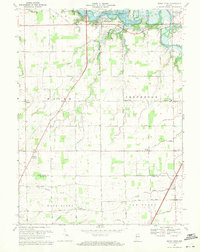
1969 Map of Mount Etna
USGS Topo · Published 1971About this map
The Salamonie Reservoir dominates the northern landscape of this survey, where the waters of the Salamonie River were harnessed for flood control and recreation. Near the shoreline, the Mount Etna State Recreation Area and the town of Mount Etna mark the interface between the newly engineered environment and the established rural layout. The land south of the water remains defined by a precise grid of roads and drainage projects like Detamore Ditch and Buck Run Ditch, illustrating the intensive management of this fertile stretch of the Indiana heartland.
Find a feature on this map
37 named features on this map. Tap any name to fly to it.
Don’t see what you’re looking for? This feature index may not catch every label — zoom into the map to look around manually.
Map Details
Editions of this 1969 Mount Etna Map
2 editions found
Other maps of this area

1950 · Lagro
USGS Topo · 1:24,000

1950 · Andrews
USGS Topo · 1:24,000

1950 · Warren
USGS Topo · 1:24,000

1950 · Mount Etna
USGS Topo · 1:24,000

1951 · Mount Etna
USGS Topo · 1:24,000

1951 · Andrews
USGS Topo · 1:24,000

1951 · Lagro
USGS Topo · 1:24,000

1952 · Warren
USGS Topo · 1:24,000

1952 · Majenica
USGS Topo · 1:24,000

1953 · La Fontaine
USGS Topo · 1:24,000