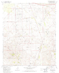
1981 Map of Mount Fagan
USGS Topo · Published 1981About this map
Mount Fagan rises as the prominent landmark of this desert landscape, where the southern reaches of the Santa Rita Mountains meet the Empire Mountains. The map reveals a region defined by scattered cattle ranching and hard-rock mining, evidenced by labels for Andrada Ranch, Hilton Ranch, and Martinez Ranch. Mining history is particularly dense along the rugged slopes, where the Cuprite Mine, Dimple Mine, and California Mine are recorded alongside numerous prospects and shafts. Water management in this arid environment is highlighted by an extensive network of man-made features like Beach Tank and Missile Tank, alongside natural sources such as Ojo Blanco Spring and Mulberry Springs. This 1981 edition also identifies a U.S. Military Reservation and a lonely cemetery near the Coronado National Forest boundary, illustrating the complex overlap of public land, private holdings, and strategic use.
Find a feature on this map
55 named features on this map. Tap any name to fly to it.
Don’t see what you’re looking for? This feature index may not catch every label — zoom into the map to look around manually.
Map Details
Editions of this 1981 Mount Fagan Map
3 editions found
Other maps of this area

1904 · Patagonia
USGS Topo · 1:125,000

1904 · Tucson
USGS Topo · 1:125,000

1905 · Patagonia
USGS Topo · 1:125,000

1905 · Tucson
USGS Topo · 1:125,000

1926 · Helvetia
USGS Topo · 1:62,500

1948 · Tucson
USGS Topo · 1:62,500

1956 · Nogales
USGS Topo · 1:250,000

1956 · Tucson
USGS Topo · 1:250,000

1957 · Tucson
USGS Topo · 1:62,500

1957 · Rincon Valley
USGS Topo · 1:62,500