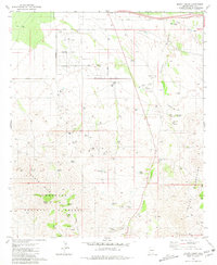
1981 Map of Mount Fagan
USGS Topo · Published 1988About this map
Coronado National Forest and the heights of Mount Fagan dominate the southwestern portion of this landscape, where mining and ranching legacies intersect. The terrain is marked by numerous resource extraction sites, including the Cuprite Mine, Dimple Mine, and Pauline Mine, alongside several quarries. This industrial footprint contrasts with long-established cattle operations like the Andrada Ranch and Hilton Ranch.
Find a feature on this map
45 named features on this map. Tap any name to fly to it.
Don’t see what you’re looking for? This feature index may not catch every label — zoom into the map to look around manually.
Map Details
Editions of this 1981 Mount Fagan Map
3 editions found
Other maps of this area

1904 · Patagonia
USGS Topo · 1:125,000

1904 · Tucson
USGS Topo · 1:125,000

1905 · Patagonia
USGS Topo · 1:125,000

1905 · Tucson
USGS Topo · 1:125,000

1926 · Helvetia
USGS Topo · 1:62,500

1948 · Tucson
USGS Topo · 1:62,500

1956 · Nogales
USGS Topo · 1:250,000

1956 · Tucson
USGS Topo · 1:250,000

1957 · Tucson
USGS Topo · 1:62,500

1957 · Rincon Valley
USGS Topo · 1:62,500