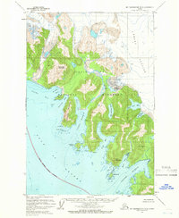
1961 Map of Mount Fairweather B-3
USGS Topo · Published 1978About this map
Brady Glacier dominates the northeastern reaches of this coastal landscape, its massive ice field punctuated by crevasses and bordering the expansive Glacier Bay National Monument. The rugged shoreline along the Gulf of Alaska is deeply indented by maritime features like Dixon Harbor and Graves Harbor, where the interaction of glacial runoff and tidal waters is evident. Inland, several freshwater bodies including North Deception Lake and South Trick Lake sit nestled between high peaks such as De Langle Mountain and Horn Mountain. The presence of the Astrolabe Peninsula and Boussole Head suggests a history of scientific exploration and maritime navigation, while the Dixon River provides a drainage path from the ice-covered interior to the sea. This coastal survey preserves the state of these retreating ice margins and untouched shorelines in the early 1960s.
Find a feature on this map
29 named features on this map. Tap any name to fly to it.
Don’t see what you’re looking for? This feature index may not catch every label — zoom into the map to look around manually.
Map Details
Editions of this 1961 Mount Fairweather B-3 Map
2 editions found
Other maps of this area

1948 · Mount Fairweather A-2
USGS Topo · 1:63,360

1948 · Mount Fairweather B-2
USGS Topo · 1:63,360

1948 · Mount Fairweather C-2
USGS Topo · 1:63,360

1950 · Mount Fairweather C-2
USGS Topo · 1:63,360

1951 · Mt Fairweather
USGS Topo · 1:250,000
1961 · Mount Fairweather A-3
USGS Topo · 1:63,360
1961 · Mount Fairweather B-3
USGS Topo · 1:63,360

1961 · Mount Fairweather C-4
USGS Topo · 1:63,360

1961 · Mount Fairweather C-3
USGS Topo · 1:63,360
1961 · Mt Fairweather B-4
USGS Topo · 1:63,360