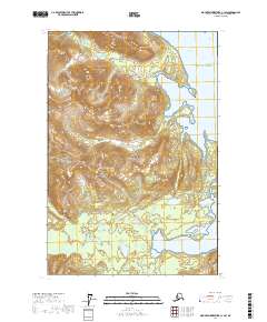
2017 Map of Mount Fairweather C-1 SW
USGS Topo · Published 2017About this map
Glacier Bay National Park encompasses the majority of this coastal wilderness, where the land meets the northern reaches of the Gulf of Alaska. The intricate shoreline is defined by deep inlets and protected waters, most notably the multi-pronged Fingers Bay and the wide opening of Berg Bay. These tidal areas represent a landscape in transition, where the marine environment of Whidbey Passage carves into the steep, unnamed coastal peaks.
Find a feature on this map
12 named features on this map. Tap any name to fly to it.
Don’t see what you’re looking for? This feature index may not catch every label — zoom into the map to look around manually.
Map Details
Editions of this 2017 Mount Fairweather C-1 SW Map
This is the sole edition of this map. No revisions or reprints were ever made.
Other maps of this area

1948 · Mount Fairweather B-1
USGS Topo · 1:63,360

1948 · Mount Fairweather B-2
USGS Topo · 1:63,360

1948 · Mount Fairweather C-1
USGS Topo · 1:63,360

1948 · Mount Fairweather C-2
USGS Topo · 1:63,360

1949 · Mount Fairweather C-1
USGS Topo · 1:63,360

1950 · Mount Fairweather C-2
USGS Topo · 1:63,360

1951 · Mt Fairweather
USGS Topo · 1:250,000

1961 · Mt Fairweather
USGS Topo · 1:250,000
2017 · Mount Fairweather B-1 NW
USGS Topo · 1:25,000
2017 · Mount Fairweather C-1 NE
USGS Topo · 1:25,000