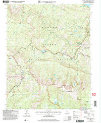
2004 Map of Mount Givens
USGS Topo · Published 2007About this map
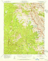
The high sierra of Sierra National Forest dominates this landscape, where the confluence of several wilderness areas meets essential water infrastructure. Near the northern boundary, the massive reservoir of Lake Thomas A Edison is fed by the South Fork San Joaquin River, a vital artery that passes by Mono Hot Springs Resort and the Gaging Station. This 2004 revision documents the intricate network of alpine lakes, including Doris Lake, Given Lake, and Lakecamp Lake, alongside managed features like the Portal Forebay and its associated Gravel Pit.
Find a feature on this map
67 named features on this map. Tap any name to fly to it.
Don’t see what you’re looking for? This feature index may not catch every label — zoom into the map to look around manually.
Map Details
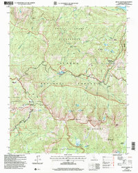
Editions of this 2004 Mount Givens Map
2 editions found
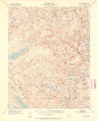
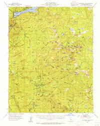
Other maps of this area

1904 · Kaiser
USGS Topo · 1:125,000

1912 · Mt. Goddard
USGS Topo · 1:125,000

1947 · Mariposa
USGS Topo · 1:250,000

1948 · Mariposa
USGS Topo · 1:250,000
1953 · Mt Abbot
USGS Topo · 1:62,500
1953 · Huntington Lake
USGS Topo · 1:62,500
1953 · Blackcap Mtn
USGS Topo · 1:62,500
1953 · Kaiser Peak
USGS Topo · 1:62,500

1957 · Mariposa
USGS Topo · 1:250,000
1962 · Blackcap Mtn
USGS Topo · 1:62,500