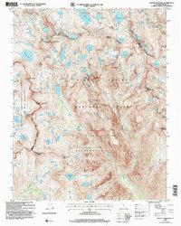
2004 Map of Mount Goddard
USGS Topo · Published 2007About this map
Mount Goddard and the surrounding high-altitude terrain of the Sierra Nevada define this high-country landscape as it was documented in the early 2000s. The area is a complex network of alpine basins and divides, where the John Muir Trail (also known as the Pacific Crest National Scenic Trail) crosses through Muir Pass. This specific survey highlights the intricate drainage patterns of Evolution Basin and the Ionian Basin, where numerous glacial lakes like Wanda Lake, Helen Lake, and Martha Lake are cradled by massive peaks such as Mount Solomons and the Black Giant. The geography is marked by the meeting of Kings Canyon National Park and the Sequoia-Kings Canyon Wilderness, showcasing deep incisions like the Enchanted Gorge and the Ragged Spur that drain into the Goddard Creek watershed.
Find a feature on this map
86 named features on this map. Tap any name to fly to it.
Don’t see what you’re looking for? This feature index may not catch every label — zoom into the map to look around manually.
Map Details
Editions of this 2004 Mount Goddard Map
2 editions found
Other maps of this area

1903 · Tehipite
USGS Topo · 1:125,000

1905 · Tehipite
USGS Topo · 1:125,000

1912 · Mt. Goddard
USGS Topo · 1:125,000

1947 · Mariposa
USGS Topo · 1:250,000

1948 · Fresno
USGS Topo · 1:250,000

1948 · Mariposa
USGS Topo · 1:250,000

1948 · Mt. Goddard
USGS Topo · 1:62,500

1951 · Mt. Goddard
USGS Topo · 1:62,500

1952 · Mt. Goddard
USGS Topo · 1:62,500

1952 · Tehipite Dome
USGS Topo · 1:62,500