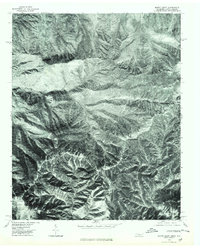
1976 Map of Mount Guyot
USGS Topo · Published 1979About this map
High peaks of the Great Smoky Mountains define this mid-1970s orthophotoquad, where the border between Tennessee and North Carolina follows a jagged ridgeline. Mount Guyot stands as the primary landmark, flanked by other significant summits including Mt Chapman and Mt Sequoyah. Unlike traditional topographic maps, this imagery-based study provides a direct aerial view of the dense forest cover and drainage patterns in the late 20th century. Deep within this wilderness, the headwaters of the Raven Fork carve through the steep terrain, while named points like Tricorner Knob and Old Black mark the intersections of these massive mountain spurs. The orthophotograph, rectified from 1976 aerial film, captures the exact state of the canopy and landform before modern digital shifts, offering a baseline for local mountain history and environmental study.
Find a feature on this map
7 named features on this map. Tap any name to fly to it.
Don’t see what you’re looking for? This feature index may not catch every label — zoom into the map to look around manually.
Map Details
Editions of this 1976 Mount Guyot Map
This is the sole edition of this map. No revisions or reprints were ever made.
Other maps of this area

1893 · Mt Guyot
USGS Topo · 1:125,000

1912 · Mt Guyot
USGS Topo · 1:125,000

1935 · Newport
USGS Topo · 1:48,000

1935 · Hartford
USGS Topo · 1:24,000

1935 · English Mountain
USGS Topo · 1:48,000

1935 · Jones Cove
USGS Topo · 1:24,000

1935 · Richardson Cove
USGS Topo · 1:24,000

1936 · Bunches Bald
USGS Topo · 1:24,000
1936 · Ravensford
USGS Topo · 1:24,000
1936 · Cartertown
USGS Topo · 1:24,000