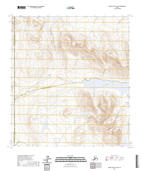
2024 Map of Mount Hayes A-5 NW
USGS Topo · Published 2024About this map
Denali Highway cuts through the southern reach of this landscape, marking a vital transit point between the Matanuska-Susitna Borough and the Copper River Census Area. The interior terrain is defined by distinct alpine corridors, including Housblack Valley and Tarn Valley, which converge near the waters of Sevenmile Lake. This 2024 survey captures the intricate drainage patterns of Boulder Creek and Rock Creek as they navigate the high-elevation basin of High Valley. The presence of Glacier Gap in the southeast corner indicates the ongoing glacial influence that has sculpted this part of the Alaska Range, offering a precise view of the modern topography and hydrological boundaries that define the region's wilderness character.
Find a feature on this map
20 named features on this map. Tap any name to fly to it.
Don’t see what you’re looking for? This feature index may not catch every label — zoom into the map to look around manually.
Map Details
Editions of this 2024 Mount Hayes A-5 NW Map
This is the sole edition of this map. No revisions or reprints were ever made.
Other maps of this area

1949 · Mount Hayes A-5
USGS Topo · 1:63,360

1950 · Mount Hayes
USGS Topo · 1:250,000

1950 · Mount Hayes A-6
USGS Topo · 1:63,360

1951 · Mount Hayes
USGS Topo · 1:250,000

1951 · Mount Hayes B-6
USGS Topo · 1:63,360

1951 · Mt. Hayes B-5
USGS Topo · 1:63,360

1952 · Mount Hayes A-6
USGS Topo · 1:63,360
1952 · Mount Hayes A-5
USGS Topo · 1:63,360

1955 · Mount Hayes
USGS Topo · 1:250,000
2016 · Mount Hayes A-5 NE
USGS Topo · 1:25,000