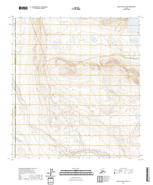
2024 Map of Mount Hayes A-5 SW
USGS Topo · Published 2024About this map
Denali Highway cuts through the high-altitude terrain along the boundary between Matanuska-Susitna Borough and the Copper River Census Area. This subarctic landscape is defined by its dramatic elevation changes, reaching a high point at Maclaren Summit and descending toward the waters of Rock Creek. The interior topography includes prominent landforms such as Whistle Ridge and the broad High Valley, illustrating the glaciated character of the Alaska Range foothills.
Find a feature on this map
15 named features on this map. Tap any name to fly to it.
Don’t see what you’re looking for? This feature index may not catch every label — zoom into the map to look around manually.
Map Details
Editions of this 2024 Mount Hayes A-5 SW Map
This is the sole edition of this map. No revisions or reprints were ever made.
Other maps of this area

1949 · Mount Hayes A-5
USGS Topo · 1:63,360

1950 · Mount Hayes
USGS Topo · 1:250,000

1950 · Mount Hayes A-6
USGS Topo · 1:63,360

1951 · Gulkana
USGS Topo · 1:250,000

1951 · Mount Hayes
USGS Topo · 1:250,000

1951 · Gulkana D-6
USGS Topo · 1:63,360

1951 · Gulkana D-5
USGS Topo · 1:63,360
1952 · Gulkana D-6
USGS Topo · 1:63,360
1952 · Gulkana D-5
USGS Topo · 1:63,360

1952 · Mount Hayes A-6
USGS Topo · 1:63,360