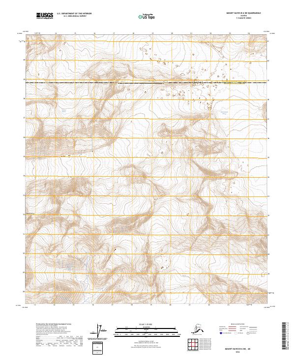
2024 Map of Mount Hayes B-6 NE
USGS Topo · Published 2024About this map
Susitna Glacier dominates the northwestern portion of this quadrangle, illustrating the massive ice flows that define the high elevations of the Alaska Range. Located at the boundary of the Southeast Fairbanks Census Area and Matanuska-Susitna Borough, the terrain is characterized by steep contours and significant glacial systems. To the east and south, the Black Rapids Glacier and Maclaren Glacier carve through the high peaks, shaping the hydrology and geomorphology of the region. This 2024 survey provides a modern topographical look at these shifting ice masses, essential for understanding the remote environment of the interior mountains.
Find a feature on this map
11 named features on this map. Tap any name to fly to it.
Don’t see what you’re looking for? This feature index may not catch every label — zoom into the map to look around manually.
Map Details
Editions of this 2024 Mount Hayes B-6 NE Map
This is the sole edition of this map. No revisions or reprints were ever made.
Other maps of this area

1950 · Mount Hayes
USGS Topo · 1:250,000

1951 · Mount Hayes
USGS Topo · 1:250,000

1951 · Mount Hayes B-6
USGS Topo · 1:63,360

1951 · Mount Hayes C-5
USGS Topo · 1:63,360

1951 · Mt. Hayes B-5
USGS Topo · 1:63,360

1951 · Mount Hayes C-6
USGS Topo · 1:63,360

1955 · Mount Hayes
USGS Topo · 1:250,000
2016 · Mount Hayes B-6 NW
USGS Topo · 1:25,000
2016 · Mount Hayes B-6 SE
USGS Topo · 1:25,000
2016 · Mount Hayes C-5 SW
USGS Topo · 1:25,000