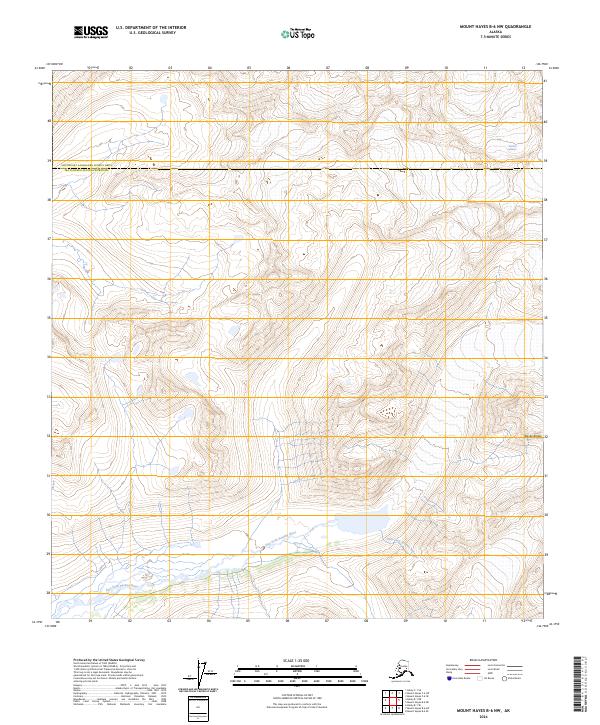
2024 Map of Mount Hayes B-6 NW
USGS Topo · Published 2024About this map
The Alaska Range dominates this landscape, where the high-altitude terrain of the Matanuska-Susitna Borough meets the Southeast Fairbanks Census Area. This specific quadrangle captures the dramatic glacial hydrology of the interior, centered on the headwaters of the East Fork Susitna River. The ice and meltwater patterns shown here provide a detailed record of the frozen landscape in 2024, including the terminal reaches of the Susitna Glacier in the northeast. The absence of roads or permanent settlements underscores the wilderness character of these townships, which are primarily defined by steep elevation contours and the dynamic flow of the river system. For researchers, the map serves as a contemporary baseline for studying the shifting margins of the glacier and the braided channels of the Susitna drainage.
Find a feature on this map
10 named features on this map. Tap any name to fly to it.
Don’t see what you’re looking for? This feature index may not catch every label — zoom into the map to look around manually.
Map Details
Editions of this 2024 Mount Hayes B-6 NW Map
This is the sole edition of this map. No revisions or reprints were ever made.
Other maps of this area

1950 · Mount Hayes
USGS Topo · 1:250,000

1950 · Healy B-1
USGS Topo · 1:63,360

1951 · Healy
USGS Topo · 1:250,000

1951 · Mount Hayes
USGS Topo · 1:250,000

1951 · Mount Hayes B-6
USGS Topo · 1:63,360

1951 · Healy C-1
USGS Topo · 1:63,360

1951 · Mount Hayes C-6
USGS Topo · 1:63,360

1952 · Healy B-1
USGS Topo · 1:63,360

1955 · Mount Hayes
USGS Topo · 1:250,000

1956 · Healy
USGS Topo · 1:250,000