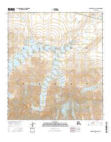
2016 Map of Mount Hayes C-6 NE
USGS Topo · Published 2016About this map
Hayes Glacier and the expansive Trident Glacier dominate this high-altitude Alaskan landscape in the Southeast Fairbanks region. The map captures a high-resolution view of the glacial terminus and the complex hydrological network that emerges from the ice, including W Hayes Cr and East Hayes Creek. This 2016 survey illustrates the raw alpine environment where drainage patterns like Contact Cr are dictated by massive ice bodies and steep elevation gradients. The absence of roads or man-made structures highlights the true wilderness character of the Alaska Range, providing a precise record of glacial positions and meltwater channels as they existed during this specific season of the mid-2010s.
Find a feature on this map
13 named features on this map. Tap any name to fly to it.
Don’t see what you’re looking for? This feature index may not catch every label — zoom into the map to look around manually.
Map Details
Editions of this 2016 Mount Hayes C-6 NE Map
This is the sole edition of this map. No revisions or reprints were ever made.
Other maps of this area

1950 · Mount Hayes
USGS Topo · 1:250,000

1950 · Mount Hayes D-6
USGS Topo · 1:63,360

1950 · Mount Hayes D-5
USGS Topo · 1:63,360

1951 · Mount Hayes
USGS Topo · 1:250,000

1951 · Mount Hayes C-5
USGS Topo · 1:63,360

1951 · Mount Hayes C-6
USGS Topo · 1:63,360

1952 · Mount Hayes D-5
USGS Topo · 1:63,360
1952 · Mount Hayes D-6
USGS Topo · 1:63,360

1955 · Mount Hayes
USGS Topo · 1:250,000
2016 · Mount Hayes D-6 SE
USGS Topo · 1:25,000