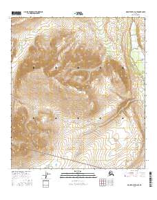
2016 Map of Mount Hayes D-6 SE
USGS Topo · Published 2016About this map
Molybdenum Ridge dominates the center of this high-elevation landscape in the Southeast Fairbanks region of Alaska. The terrain is defined by a series of steep drainages, including the headwaters of Ptarmigan Cr and Contact Cr, which carve through the high country. Toward the eastern edge, Delta Creek provides a significant hydrological marker for the area. This 2016 survey shows the territory partitioned by the Public Land Survey System, specifically within the boundaries of t12s r5e, t12s r6e, t13s r5e, and t13s r6e. The map serves as a record of this unpopulated wilderness area, detailing the natural flow of mountain streams and the complex relief of the interior Alaska landscape.
Find a feature on this map
8 named features on this map. Tap any name to fly to it.
Don’t see what you’re looking for? This feature index may not catch every label — zoom into the map to look around manually.
Map Details
Editions of this 2016 Mount Hayes D-6 SE Map
This is the sole edition of this map. No revisions or reprints were ever made.
Other maps of this area

1950 · Mount Hayes
USGS Topo · 1:250,000

1950 · Mount Hayes D-6
USGS Topo · 1:63,360

1950 · Mount Hayes D-5
USGS Topo · 1:63,360

1951 · Mount Hayes
USGS Topo · 1:250,000

1951 · Mount Hayes C-5
USGS Topo · 1:63,360

1951 · Mount Hayes C-6
USGS Topo · 1:63,360

1952 · Mount Hayes D-5
USGS Topo · 1:63,360
1952 · Mount Hayes D-6
USGS Topo · 1:63,360

1955 · Mount Hayes
USGS Topo · 1:250,000
2013 · Mount Hayes D-5 NW
USGS Topo · 1:25,000