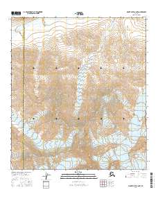
2016 Map of Mount Hayes C-6 NW
USGS Topo · Published 2016About this map
Hayes Glacier and Gillam Glacier dominate the southern portion of this high-altitude landscape, marking a terrain defined by ice and significant mountain peaks. The map details the administrative boundary where the Denali Borough meets the Southeast Fairbanks Census Area, a line that cuts through some of the region's most prominent summits. Peaks such as Mt Giddings, Mt Skarland, and Mt Geist stand as permanent landmarks among the moving ice fields. Drainage patterns for the area are established by the East Fork Little Delta River and Whistler Creek, which carry glacial runoff northward. This survey provides an exact look at the glaciated topography and hydrological flow at the start of the twenty-first century.
Find a feature on this map
16 named features on this map. Tap any name to fly to it.
Don’t see what you’re looking for? This feature index may not catch every label — zoom into the map to look around manually.
Map Details
Editions of this 2016 Mount Hayes C-6 NW Map
This is the sole edition of this map. No revisions or reprints were ever made.
Other maps of this area

1949 · Healy D-1
USGS Topo · 1:63,360

1950 · Mount Hayes
USGS Topo · 1:250,000

1950 · Mount Hayes D-6
USGS Topo · 1:63,360

1951 · Healy
USGS Topo · 1:250,000

1951 · Mount Hayes
USGS Topo · 1:250,000

1951 · Healy C-1
USGS Topo · 1:63,360

1951 · Mount Hayes C-6
USGS Topo · 1:63,360
1952 · Healy D-1
USGS Topo · 1:63,360
1952 · Mount Hayes D-6
USGS Topo · 1:63,360

1955 · Mount Hayes
USGS Topo · 1:250,000