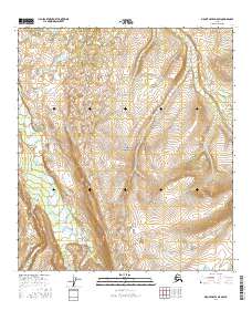
2016 Map of Mount Hayes D-5 SW
USGS Topo · Published 2016About this map
Delta Creek flows through this interior Alaskan wilderness, cutting a broad drainage path southward across the landscape. The topographic data reveals a complex network of high-elevation drainages, including the headwaters of Ptarmigan Cr and the multi-channeled East Hayes Creek. The terrain is defined by dramatic elevation changes, where seasonal snowmelt feeds these waterways as they descend from the higher reaches of the Alaska Range. This 2016 survey illustrates a largely untouched landscape, where natural watercourses and the Public Land Survey System grids—such as t13s r7e and t12s r7e—are the primary markers of human organization in this vast subarctic environment.
Find a feature on this map
9 named features on this map. Tap any name to fly to it.
Don’t see what you’re looking for? This feature index may not catch every label — zoom into the map to look around manually.
Map Details
Editions of this 2016 Mount Hayes D-5 SW Map
This is the sole edition of this map. No revisions or reprints were ever made.
Other maps of this area

1950 · Mount Hayes
USGS Topo · 1:250,000

1950 · Mount Hayes D-6
USGS Topo · 1:63,360

1950 · Mount Hayes D-5
USGS Topo · 1:63,360

1951 · Mount Hayes
USGS Topo · 1:250,000

1951 · Mount Hayes C-5
USGS Topo · 1:63,360

1951 · Mount Hayes C-6
USGS Topo · 1:63,360

1952 · Mount Hayes D-5
USGS Topo · 1:63,360
1952 · Mount Hayes D-6
USGS Topo · 1:63,360

1955 · Mount Hayes
USGS Topo · 1:250,000
2013 · Mount Hayes D-5 NW
USGS Topo · 1:25,000