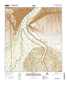
2016 Map of Mount Hayes D-6 NW
USGS Topo · Published 2016About this map
The Little Delta River dominates this interior Alaskan landscape, carving a wide gravel-braided valley through the north-central portion of the map. This 2016 survey documents the complex hydrological patterns of the region, specifically where the West Fork Little Delta River and the East Fork Little Delta River converge to form the main stem. The topography transitions from high, deeply dissected ridges in the north to a low-lying, lake-strewn basin in the south, characteristic of the glacial outwash plains found in the Denali Borough and Southeast Fairbanks Census Area borderlands. Smaller tributaries like Buchanan Cr and Iowa Cr drain the surrounding uplands, feeding into the primary glacial river system. This map is particularly valuable for understanding the modern geomorphology of the river forks before they reach the Tanana Valley to the north.
Find a feature on this map
12 named features on this map. Tap any name to fly to it.
Don’t see what you’re looking for? This feature index may not catch every label — zoom into the map to look around manually.
Map Details
Editions of this 2016 Mount Hayes D-6 NW Map
This is the sole edition of this map. No revisions or reprints were ever made.
Other maps of this area

1949 · Big Delta A-6
USGS Topo · 1:63,360

1949 · Fairbanks A-1
USGS Topo · 1:63,360

1949 · Healy D-1
USGS Topo · 1:63,360

1950 · Fairbanks
USGS Topo · 1:250,000

1950 · Mount Hayes
USGS Topo · 1:250,000

1950 · Big Delta
USGS Topo · 1:250,000

1950 · Mount Hayes D-6
USGS Topo · 1:63,360

1951 · Healy
USGS Topo · 1:250,000

1951 · Big Delta
USGS Topo · 1:250,000

1951 · Mount Hayes
USGS Topo · 1:250,000