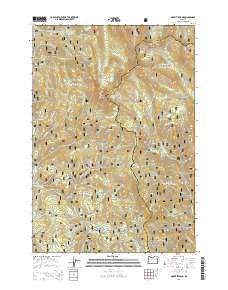
2014 Map of Mount Ireland
USGS Topo · Published 2014About this map
Mount Ireland and the surrounding high-elevation terrain of the Whitman National Forest dominate this landscape along the border of Grant and Baker counties. The area is characterized by a series of high ridges and deep drainages, including the Elkhorn Mountains to the east and the prominent Grays Peak to the south. Historically significant meadows and clearings such as Gold Center Meadow, Mahoney Meadows, and Bear Meadow suggest the region's long-standing use for grazing or early mountain settlement, while features like Cable Cove and Umpqua Gulch mark the complex topography.
Find a feature on this map
63 named features on this map. Tap any name to fly to it.
Don’t see what you’re looking for? This feature index may not catch every label — zoom into the map to look around manually.
Map Details
Editions of this 2014 Mount Ireland Map
This is the sole edition of this map. No revisions or reprints were ever made.
Other maps of this area

1901 · Sumpter
USGS Topo · 1:125,000

1955 · Canyon City
USGS Topo · 1:250,000

1959 · Canyon City
USGS Topo · 1:250,000

1961 · Whitney
USGS Topo · 1:24,000

1972 · Trout Meadows
USGS Topo · 1:24,000

1972 · Mt. Ireland
USGS Topo · 1:24,000
1972 · Bourne
USGS Topo · 1:24,000
1972 · Granite
USGS Topo · 1:24,000
1972 · Sumpter
USGS Topo · 1:24,000

1972 · Greenhorn
USGS Topo · 1:24,000