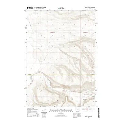
2015 Map of Mount Jackson
USGS Topo · Published 2015About this map
Yellowstone National Park defines this section of the Wyoming wilderness, where the Madison River carves its path through Madison Canyon. The landscape is dominated by significant elevations such as Mt Jackson and Mt Haynes, which overlook the western entrance corridor of the park. This 2015 survey illustrates a terrain dictated by hydrology and volcanic geography, with Harlequin Lake tucked into the eastern reaches and the Three Brothers Mountains rising in the southeast. Historical access to this backcountry is marked by the Gneiss Creek Trail and the Cougar Cabin Trail, showing the primitive infrastructure maintained for park management and explorers. The transition between Park County and Teton County is noted in the southern portion of the quadrangle, reflecting the administrative boundaries that intersect this protected natural area.
Find a feature on this map
19 named features on this map. Tap any name to fly to it.
Don’t see what you’re looking for? This feature index may not catch every label — zoom into the map to look around manually.
Map Details
Editions of this 2015 Mount Jackson Map
This is the sole edition of this map. No revisions or reprints were ever made.
Other maps of this area

1885 · Gallatin
USGS Topo · 1:125,000

1885 · Gallatin
USGS Topo · 1:125,000

1901 · Gallatin
USGS Topo · 1:125,000

1908 · Gallatin
USGS Topo · 1:125,000

1911 · Gallatin
USGS Topo · 1:125,000

1955 · Ashton
USGS Topo · 1:250,000

1958 · Ashton
USGS Topo · 1:250,000

1958 · Madison Junction
USGS Topo · 1:62,500

1958 · Mount Holmes
USGS Topo · 1:62,500

1958 · West Yellowstone
USGS Topo · 1:62,500