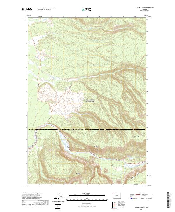
2021 Map of Mount Jackson
USGS Topo · Published 2021About this map
Yellowstone National Park dominates this landscape, where the Madison River carves a path through the steep walls of Madison Canyon. The terrain is defined by significant peaks including Mt Jackson, Mt Haynes, and the Three Brothers Mountains to the south. Transportation and access are limited to the corridor of the West Entrance Rd and Riverside Drive, alongside primitive routes like the Gneiss Creek Trl and Cougar Cabin Trl. The transition from the broad Madison Valley into the high volcanic plateaus is evident, with water features such as Harlequin Lake and Cougar Cr highlighting the drainage patterns of the western park interior.
Find a feature on this map
21 named features on this map. Tap any name to fly to it.
Don’t see what you’re looking for? This feature index may not catch every label — zoom into the map to look around manually.
Map Details
Editions of this 2021 Mount Jackson Map
This is the sole edition of this map. No revisions or reprints were ever made.
Other maps of this area

1885 · Gallatin
USGS Topo · 1:125,000

1885 · Gallatin
USGS Topo · 1:125,000

1901 · Gallatin
USGS Topo · 1:125,000

1908 · Gallatin
USGS Topo · 1:125,000

1911 · Gallatin
USGS Topo · 1:125,000

1955 · Ashton
USGS Topo · 1:250,000

1958 · Ashton
USGS Topo · 1:250,000

1958 · Madison Junction
USGS Topo · 1:62,500

1958 · Mount Holmes
USGS Topo · 1:62,500

1958 · West Yellowstone
USGS Topo · 1:62,500