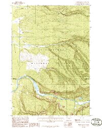
1986 Map of Mount Jackson
USGS Topo · Published 1986About this map
Yellowstone National Park terrain dominates this mid-1980s provisional survey, which illustrates the dramatic topography where the Madison River carves through the landscape. The river passes through the steep walls of Madison Canyon, flanked by high summits including Mount Jackson and Mount Haynes. To the west, the canyon opens into the broader Madison Valley, showing the transition from high-elevation peaks to lower basins. Significant natural features such as Purple Mountain and the Three Brothers Mountains are detailed alongside minor water bodies like Harlequin Lake and Duck Creek. This edition captures the wilderness character of northwestern Wyoming prior to the major wildfires of the late 1980s, providing a clear record of the established drainage patterns of Maple Creek and Cougar Creek and the early backcountry access via the noted Pack Trail.
Find a feature on this map
14 named features on this map. Tap any name to fly to it.
Don’t see what you’re looking for? This feature index may not catch every label — zoom into the map to look around manually.
Map Details
Editions of this 1986 Mount Jackson Map
This is the sole edition of this map. No revisions or reprints were ever made.
Other maps of this area

1885 · Gallatin
USGS Topo · 1:125,000

1885 · Gallatin
USGS Topo · 1:125,000

1901 · Gallatin
USGS Topo · 1:125,000

1908 · Gallatin
USGS Topo · 1:125,000

1911 · Gallatin
USGS Topo · 1:125,000

1955 · Ashton
USGS Topo · 1:250,000

1958 · Ashton
USGS Topo · 1:250,000

1958 · Madison Junction
USGS Topo · 1:62,500

1958 · Mount Holmes
USGS Topo · 1:62,500

1958 · West Yellowstone
USGS Topo · 1:62,500