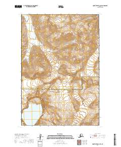
2019 Map of Mount Katmai B-3 SW
USGS Topo · Published 2019About this map
Katmai National Park encompasses a landscape defined by dramatic geological activity and glacial movement within the Lake and Peninsula and Kodiak Island Borough boundary. The southern portion of the map is dominated by the prominent Crater Lake, a concentrated body of water situated within high-elevation terrain. Extending from the north and east, massive ice fields including The Knife Creek Glaciers and the winding Serpent Tongue Glacier illustrate the ongoing glacial processes that carve these high valleys. To the southeast, Noisy Mtn stands as a significant landmark above the surrounding drainage basins, including the headwaters of Ikagluik Creek. This survey provides a precise record of these shifting ice margins and volcanic features as they appeared in the early 21st century, serving as a baseline for environmental and topographic study in the Aleutian Range.
Find a feature on this map
11 named features on this map. Tap any name to fly to it.
Don’t see what you’re looking for? This feature index may not catch every label — zoom into the map to look around manually.
Map Details
Editions of this 2019 Mount Katmai B-3 SW Map
This is the sole edition of this map. No revisions or reprints were ever made.
Other maps of this area

1948 · Mt Katmai
USGS Topo · 1:250,000

1951 · Mt Katmai
USGS Topo · 1:250,000

1951 · Mount Katmai A-3
USGS Topo · 1:63,360

1951 · Mount Katmai B-4
USGS Topo · 1:63,360

1951 · Mount Katmai A-4
USGS Topo · 1:63,360

1951 · Mount Katmai B-3
USGS Topo · 1:63,360

1964 · Mt. Katmai
USGS Topo · 1:250,000
2019 · Mount Katmai B-3 SE
USGS Topo · 1:25,000
2019 · Mount Katmai A-3 NE
USGS Topo · 1:25,000
2019 · Mount Katmai B-3 NE
USGS Topo · 1:25,000