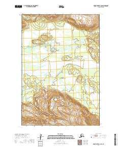
2019 Map of Mount Katmai C-3 SW
USGS Topo · Published 2019About this map
Katmai National Park encompasses this wilderness landscape where glacial drainage and river systems carve through the terrain of south-central Alaska. The Savonoski River dominates the central portion of the map, flowing across a wide, braided valley floor that indicates a high sediment load typical of glacier-fed waterways in this region. To the north, the smaller Hardscrabble Creek (also labeled as Hardscrabble Cr) feeds into the larger drainage system. The absence of roads or settlements emphasizes the remote nature of this protected interior, where the landscape is defined entirely by natural hydrology and topographical contours. This survey provides a baseline of the river's path and the surrounding elevations during the early twenty-first century, useful for tracking long-term geomorphological changes in the park.
Find a feature on this map
8 named features on this map. Tap any name to fly to it.
Don’t see what you’re looking for? This feature index may not catch every label — zoom into the map to look around manually.
Map Details
Editions of this 2019 Mount Katmai C-3 SW Map
This is the sole edition of this map. No revisions or reprints were ever made.
Other maps of this area

1948 · Mt Katmai
USGS Topo · 1:250,000

1951 · Mt Katmai
USGS Topo · 1:250,000

1951 · Mount Katmai C-3
USGS Topo · 1:63,360

1951 · Mount Katmai B-4
USGS Topo · 1:63,360

1951 · Mount Katmai C-4
USGS Topo · 1:63,360

1951 · Mount Katmai B-3
USGS Topo · 1:63,360

1964 · Mt. Katmai
USGS Topo · 1:250,000
2019 · Mount Katmai B-3 NE
USGS Topo · 1:25,000
2019 · Mount Katmai B-4 NE
USGS Topo · 1:25,000
2019 · Mount Katmai C-4 SE
USGS Topo · 1:25,000