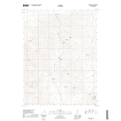
2018 Map of Mount Lewis
USGS Topo · Published 2018About this map
Mt Lewis dominates the high desert terrain of the Shoshone Range in this modern topographic study of Lander County. The high-altitude settlement of Hilltop is positioned near the center of the quadrangle, serving as a focal point for the surrounding network of canyons and peaks. The landscape is defined by its water sources and drainage patterns, including Indian Box Spring, Tunnel Spring, and the winding course of Rock Cr.
Find a feature on this map
36 named features on this map. Tap any name to fly to it.
Don’t see what you’re looking for? This feature index may not catch every label — zoom into the map to look around manually.
Map Details
Editions of this 2018 Mount Lewis Map
This is the sole edition of this map. No revisions or reprints were ever made.
Other maps of this area

1949 · Crescent Valley
USGS Topo · 1:62,500

1949 · Mt. Lewis
USGS Topo · 1:62,500

1950 · Mt. Lewis
USGS Topo · 1:62,500

1950 · Crescent Valley
USGS Topo · 1:62,500

1955 · Winnemucca
USGS Topo · 1:250,000

1957 · Dunphy
USGS Topo · 1:62,500

1957 · Battle Mountain
USGS Topo · 1:62,500

1958 · Winnemucca
USGS Topo · 1:250,000

1962 · Winnemucca
USGS Topo · 1:250,000

1985 · Mud Spring Gulch
USGS Topo · 1:24,000