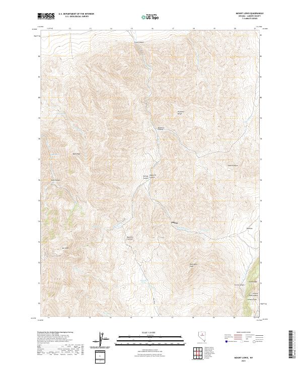
2021 Map of Mount Lewis
USGS Topo · Published 2021About this map
Hilltop serves as the primary point of historical interest in this high-elevation region of the Shoshone Range. Situated between the steep drainages of Hilltop Canyon and Maysville Canyon, the area is defined by massive peaks including Mt Lewis and Bens Peak. The landscape is a network of named summits and deep canyons, where water sources like Indian Box Spring and Tunnel Spring provided essential relief in the arid terrain. The presence of Hill Top Rd winding through the central mountains towards Maysville Summit indicates the established routes used to navigate this portion of Lander County. To the southeast, the terrain transitions at Granite Dixie Pass near O'Haras Peak, marking a significant topographical break between the high ridges and the surrounding basins.
Find a feature on this map
35 named features on this map. Tap any name to fly to it.
Don’t see what you’re looking for? This feature index may not catch every label — zoom into the map to look around manually.
Map Details
Editions of this 2021 Mount Lewis Map
This is the sole edition of this map. No revisions or reprints were ever made.
Other maps of this area

1949 · Crescent Valley
USGS Topo · 1:62,500

1949 · Mt. Lewis
USGS Topo · 1:62,500

1950 · Mt. Lewis
USGS Topo · 1:62,500

1950 · Crescent Valley
USGS Topo · 1:62,500

1955 · Winnemucca
USGS Topo · 1:250,000

1957 · Dunphy
USGS Topo · 1:62,500

1957 · Battle Mountain
USGS Topo · 1:62,500

1958 · Winnemucca
USGS Topo · 1:250,000

1962 · Winnemucca
USGS Topo · 1:250,000

1985 · Mud Spring Gulch
USGS Topo · 1:24,000