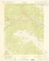
1948 Map of Mount Logan
USGS Topo · Published 1948About this map
The North Fork South Platte River carves a central valley through this high-altitude landscape of Park County, where the small settlements of Webster, Grant, and Santa Maria follow the river and the path of Highway 285. The terrain is dominated by the massive summits of the Kenosha Mtns, including Mount Logan, North Twin Cone Peak, and South Twin Cone Peak. Numerous drainage gulches, such as Whiteside Gulch and Ben Tyler Gulch, feed into the river system from the surrounding slopes of the Pike National Forest.
Find a feature on this map
33 named features on this map. Tap any name to fly to it.
Don’t see what you’re looking for? This feature index may not catch every label — zoom into the map to look around manually.
Map Details
Editions of this 1948 Mount Logan Map
2 editions found
Other maps of this area

1903 · Georgetown
USGS Topo · 1:62,500

1905 · Georgetown
USGS Topo · 1:62,500

1924 · Montezuma
USGS Topo · 1:62,500

1926 · Montezuma
USGS Topo · 1:62,500

1933 · Montezuma
USGS Topo · 1:62,500

1937 · Como
USGS Topo · 1:62,500

1945 · Shawnee
USGS Topo · 1:24,000

1945 · Mount Logan
USGS Topo · 1:24,000

1948 · Mount Logan
USGS Topo · 1:24,000

1948 · Shawnee
USGS Topo · 1:24,000