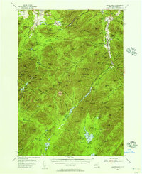
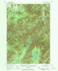
1953 Map of Mount Marcy
USGS Topo · Published 1957About this map
Mt Marcy stands as the central focal point of this 1950s survey, anchoring a complex system of drainage and high-altitude terrain. The map details the intricate network of alpine trails that served hikers and climbers of the era, including the Van Hoevenberg Trail and the Range Trail. Water features like the high-elevation Lake Tear of the Clouds and the Opalescent River illustrate the hydrology of the High Peaks region before modern developments altered local access.
Find a feature on this map
177 named features on this map. Tap any name to fly to it.
Don’t see what you’re looking for? This feature index may not catch every label — zoom into the map to look around manually.
Map Details
Editions of this 1953 Mount Marcy Map
5 editions found
Other maps of this area

1894 · Elizabethtown
USGS Topo · 1:62,500

1895 · Elizabethtown
USGS Topo · 1:62,500

1895 · Mt. Marcy
USGS Topo · 1:62,500

1895 · Ausable
USGS Topo · 1:62,500

1895 · Paradox Lake
USGS Topo · 1:62,500

1896 · Lake Placid
USGS Topo · 1:62,500

1897 · Paradox Lake
USGS Topo · 1:62,500

1897 · Schroon Lake
USGS Topo · 1:62,500

1898 · Newcomb
USGS Topo · 1:62,500

1898 · Lake Placid
USGS Topo · 1:62,500