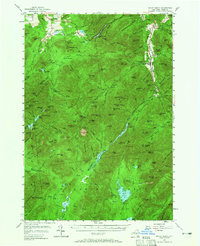
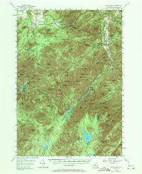
1953 Map of Mount Marcy
USGS Topo · Published 1965About this map
Keene Valley and the surrounding High Peaks wilderness appear here as surveyed in the early 1950s, showing a landscape defined by its alpine lakes and early recreational infrastructure. The map documents significant athletic and tourism sites such as the Olympic Bobsled Run and the Adirondak Loj near Heart Lake, marking the region's mid-century status as a premier destination for winter sports and hiking.
Find a feature on this map
115 named features on this map. Tap any name to fly to it.
Don’t see what you’re looking for? This feature index may not catch every label — zoom into the map to look around manually.
Map Details
Editions of this 1953 Mount Marcy Map
5 editions found
Other maps of this area

1894 · Elizabethtown
USGS Topo · 1:62,500

1895 · Elizabethtown
USGS Topo · 1:62,500

1895 · Mt. Marcy
USGS Topo · 1:62,500

1895 · Ausable
USGS Topo · 1:62,500

1895 · Paradox Lake
USGS Topo · 1:62,500

1896 · Lake Placid
USGS Topo · 1:62,500

1897 · Paradox Lake
USGS Topo · 1:62,500

1897 · Schroon Lake
USGS Topo · 1:62,500

1898 · Newcomb
USGS Topo · 1:62,500

1898 · Lake Placid
USGS Topo · 1:62,500