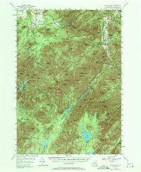
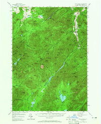
1953 Map of Mount Marcy
USGS Topo · Published 1971About this map
The Olympic Bobsled Run on the slopes of Mt Van Hoevenburg stands as a notable landmark in this mid-century survey of the High Peaks region. Entirely contained within Adirondack State Park, the landscape is defined by the headwaters of the West Branch Ausable River and the East Branch Ausable River, which flank the central mountain mass. Small settlements like North Elba and Saint Huberts are connected by historic routes, including the Old Military Road and the Van Hoevenberg Trail.
Find a feature on this map
162 named features on this map. Tap any name to fly to it.
Don’t see what you’re looking for? This feature index may not catch every label — zoom into the map to look around manually.
Map Details
Editions of this 1953 Mount Marcy Map
5 editions found
Other maps of this area

1894 · Elizabethtown
USGS Topo · 1:62,500

1895 · Elizabethtown
USGS Topo · 1:62,500

1895 · Mt. Marcy
USGS Topo · 1:62,500

1895 · Ausable
USGS Topo · 1:62,500

1895 · Paradox Lake
USGS Topo · 1:62,500

1896 · Lake Placid
USGS Topo · 1:62,500

1897 · Paradox Lake
USGS Topo · 1:62,500

1897 · Schroon Lake
USGS Topo · 1:62,500

1898 · Newcomb
USGS Topo · 1:62,500

1898 · Lake Placid
USGS Topo · 1:62,500