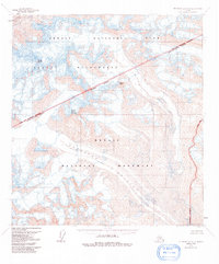
1954 Map of Mount McKinley A-1
USGS Topo · Published 1991About this map
Eldridge Glacier dominates the southern reaches of this landscape, its massive icy flow flanked by high-altitude summits including Mount Eldridge and Sunset Peak. This 1954 survey, which was later revised to reflect the legislative shifts of the 1980s, highlights the complex administrative layering of the Denali National Park and Denali Wilderness areas. A distinct Monument Boundary and Park and Wilderness Boundary bisect the terrain, marking the intersection of the Matanuska-Susitna Borough with these federally protected lands. To the northwest, the Muldrow Glacier and the peak of Mount Mather define the high-relief topography. The lack of roads or trails on this sheet underscores the preservation of this region as a wilderness area during the mid-20th century, prior to the significant minor revisions noted in 1991.
Find a feature on this map
10 named features on this map. Tap any name to fly to it.
Don’t see what you’re looking for? This feature index may not catch every label — zoom into the map to look around manually.
Map Details
Editions of this 1954 Mount McKinley A-1 Map
3 editions found

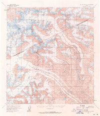
Other maps of this area

1949 · Talkeetna Mountains D-6
USGS Topo · 1:63,360

1949 · Healy A-6
USGS Topo · 1:63,360

1950 · Talkeetna Mountains
USGS Topo · 1:250,000

1950 · Talkeetna
USGS Topo · 1:250,000

1951 · Talkeetna
USGS Topo · 1:250,000

1951 · Healy
USGS Topo · 1:250,000

1951 · Talkeetna Mountains D-6
USGS Topo · 1:63,360

1952 · Mount McKinley
USGS Topo · 1:250,000

1952 · Talkeetna Mountains D-6
USGS Topo · 1:63,360

1952 · Mount McKinley B-2
USGS Topo · 1:63,360