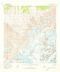
1954 Map of Mount McKinley A-3
USGS Topo · Published 1973About this map
Mount Mc Kinley dominates this mid-century topographic survey, showing the peak as it was mapped by the Geological Survey and the Museum of Science, Boston. The map details the massive glacial systems flowing from the heights, including the Straightaway Glacier and the Kahiltna Glacier, as they existed before modern recessions. To the north, the terrain drops from the Wickersham Wall toward the drainage of Birch Creek and Slippery Creek. Though the landscape is defined by ice and rock, a lone Mine label in the northern hills hints at the early 20th-century prospecting that occurred near the Mt Mc Kinley National Park boundary. Landmark climbing features like Denali Pass, Archdeacons Tower, and Windy Corner are all identified, providing a technical look at the mountain during an era of significant alpine exploration.
Find a feature on this map
36 named features on this map. Tap any name to fly to it.
Don’t see what you’re looking for? This feature index may not catch every label — zoom into the map to look around manually.
Map Details
Editions of this 1954 Mount McKinley A-3 Map
4 editions found

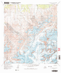
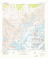
Other maps of this area

1950 · Talkeetna
USGS Topo · 1:250,000

1951 · Talkeetna
USGS Topo · 1:250,000

1952 · Mount McKinley
USGS Topo · 1:250,000

1952 · Mount McKinley B-2
USGS Topo · 1:63,360

1953 · Mount McKinley B-4
USGS Topo · 1:63,360

1953 · Mount McKinley B-3
USGS Topo · 1:63,360

1953 · Mount McKinley A-4
USGS Topo · 1:63,360

1954 · Mount McKinley A-4
USGS Topo · 1:63,360

1954 · Mount McKinley B-3
USGS Topo · 1:63,360

1954 · Mount McKinley A-2
USGS Topo · 1:63,360