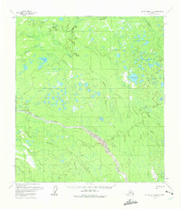
1958 Map of Mount McKinley B-6
USGS Topo · Published 1975About this map
Winter Trail segments cross this interior Alaskan landscape, marking the traditional overland routes through the Yukon-Koyukuk region during the mid-1950s. The terrain is defined by a dense network of braided waterways and muskeg, where the Swift Fork and Middle Fork converge toward the Slow Fork. This hydrography creates a complex system of seasonal drainage and permanent water bodies, including Shisnona Lake and the smaller Dull Ax Lake.
Find a feature on this map
17 named features on this map. Tap any name to fly to it.
Don’t see what you’re looking for? This feature index may not catch every label — zoom into the map to look around manually.
Map Details
Editions of this 1958 Mount McKinley B-6 Map
2 editions found

Other maps of this area

1950 · Medfra
USGS Topo · 1:250,000

1952 · Mount McKinley
USGS Topo · 1:250,000

1952 · Mount McKinley A-5
USGS Topo · 1:63,360

1953 · Mount McKinley C-5
USGS Topo · 1:63,360

1953 · Mount McKinley B-5
USGS Topo · 1:63,360

1954 · Mount McKinley B-5
USGS Topo · 1:63,360

1954 · Mount McKinley A-5
USGS Topo · 1:63,360

1954 · Mount McKinley C-5
USGS Topo · 1:63,360

1958 · Medfra C-1
USGS Topo · 1:63,360

1958 · Medfra A-1
USGS Topo · 1:63,360