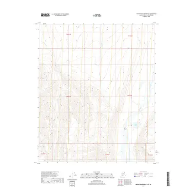
2018 Map of Mount Michelson B-1 NE
USGS Topo · Published 2018About this map
The Okpilak Valley dominates this 2018 survey of Alaska's North Slope, where the drainage systems of the Okpilak River and Akutoktak River carve through high-elevation terrain. This map reveals a landscape defined by glacial and fluvial processes, centering on the prominent Okpilak Lake and the winding course of Old Man Cr in the western reaches. The absence of human infrastructure highlights the untouched character of the North Slope Borough, where land use is dictated by the natural topography and the seasonal flow of arctic waterways. For researchers of Alaskan geography, the map provides a precise look at the township and range boundaries including t1n r33e and t2n r33e, documenting the foundational survey lines of this remote northern interior.
Find a feature on this map
12 named features on this map. Tap any name to fly to it.
Don’t see what you’re looking for? This feature index may not catch every label — zoom into the map to look around manually.
Map Details
Editions of this 2018 Mount Michelson B-1 NE Map
This is the sole edition of this map. No revisions or reprints were ever made.
Other maps of this area

1951 · Demarcation Point
USGS Topo · 1:250,000

1951 · Mt. Michelson
USGS Topo · 1:250,000

1955 · Demarcation Point
USGS Topo · 1:250,000

1955 · Mount Michelson B-1
USGS Topo · 1:63,360

1955 · Mount Michelson C-1
USGS Topo · 1:63,360

1955 · Demarcation Point C-5
USGS Topo · 1:63,360

1956 · Mt. Michelson
USGS Topo · 1:250,000

1956 · Demarcation Point B-5
USGS Topo · 1:63,360

1964 · Demarcation Point
USGS Topo · 1:250,000
2018 · Mount Michelson B-1 SW
USGS Topo · 1:25,000