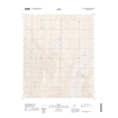
2023 Map of Mount Michelson B-1 NE
USGS Topo · Published 2023About this map
The Mollie Beattie Wilderness and the Arctic National Wildlife Refuge define the character of this northern landscape. The map centers on the high-latitude drainage systems where the Akutoktak River and the Okpilak River flow north toward the Beaufort Sea. The topography is dominated by the deeply carved Okpilak Valley, which contains the small Okpilak Lake at its base. Unlike more settled regions, this area is marked by a complete absence of roads or permanent structures, reflecting its status as protected wilderness. Surveyed by the U.S. Geological Survey, the map provides a precise account of the drainage patterns of Old Man Creek and its surrounding ridgelines. The transition between various township and range boundaries, such as t1n r33e and t2n r33e, indicates the systematic grid applied even to this undeveloped frontier.
Find a feature on this map
14 named features on this map. Tap any name to fly to it.
Don’t see what you’re looking for? This feature index may not catch every label — zoom into the map to look around manually.
Map Details
Editions of this 2023 Mount Michelson B-1 NE Map
This is the sole edition of this map. No revisions or reprints were ever made.
Other maps of this area

1951 · Demarcation Point
USGS Topo · 1:250,000

1951 · Mt. Michelson
USGS Topo · 1:250,000

1955 · Demarcation Point
USGS Topo · 1:250,000

1955 · Mount Michelson B-1
USGS Topo · 1:63,360

1955 · Mount Michelson C-1
USGS Topo · 1:63,360

1955 · Demarcation Point C-5
USGS Topo · 1:63,360

1956 · Mt. Michelson
USGS Topo · 1:250,000

1956 · Demarcation Point B-5
USGS Topo · 1:63,360

1964 · Demarcation Point
USGS Topo · 1:250,000
2018 · Mount Michelson B-1 SW
USGS Topo · 1:25,000