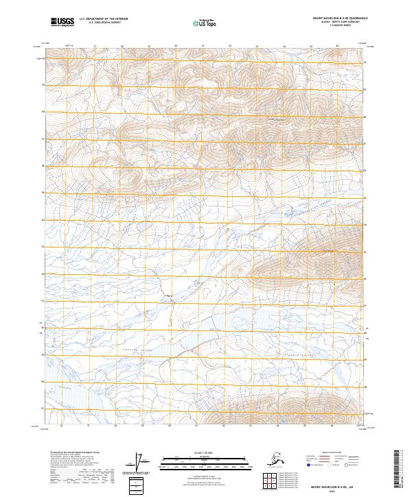
2024 Map of Mount Michelson B-4 NE
USGS Topo · Published 2024About this map
The Mollie Beattie Wilderness forms the core of this landscape, situated deep within the Arctic National Wildlife Refuge. This terrain is defined by the sharp vertical relief of the Shublik Mountains and the Third Range, which run parallel to the coastal plain. Between these peaks lie significant glacial and fluvial depressions, including the Ikiakpaurak Valley and the Ikiakpuk Valley. These corridors facilitate the movement of water and wildlife through an otherwise formidable mountain barrier.
Find a feature on this map
19 named features on this map. Tap any name to fly to it.
Don’t see what you’re looking for? This feature index may not catch every label — zoom into the map to look around manually.
Map Details
Editions of this 2024 Mount Michelson B-4 NE Map
This is the sole edition of this map. No revisions or reprints were ever made.
Other maps of this area

1951 · Mt. Michelson
USGS Topo · 1:250,000

1955 · Mount Michelson C-3
USGS Topo · 1:63,360

1955 · Mount Michelson C-4
USGS Topo · 1:63,360

1956 · Mt. Michelson
USGS Topo · 1:250,000

1956 · Mount Michelson B-3
USGS Topo · 1:63,360

1975 · Mount Michelson C-3
USGS Topo · 1:63,360

1978 · Mount Michelson C-4
USGS Topo · 1:63,360
1983 · Mount Michelson B-4
USGS Topo · 1:63,360
2018 · Mount Michelson B-4 NE
USGS Topo · 1:25,000
2018 · Mount Michelson C-4 SE
USGS Topo · 1:25,000