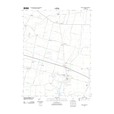
2010 Map of Mount Orab
USGS Topo · Published 2010About this map
Mount Orab serves as the primary hub of this Brown County landscape, situated at the intersection of significant local transit routes like the Tri County Hwy. The village is anchored by essential civic landmarks including the Mount Orab Post Office and the Mount Orab Cemetery. The surrounding countryside is defined by a dense network of family-named roads and small rural settlements such as Stringtown, Greenbush, and Eastwood.
Find a feature on this map
85 named features on this map. Tap any name to fly to it.
Don’t see what you’re looking for? This feature index may not catch every label — zoom into the map to look around manually.
Map Details
Editions of this 2010 Mount Orab Map
This is the sole edition of this map. No revisions or reprints were ever made.
Other maps of this area

1914 · Batavia
USGS Topo · 1:48,000

1916 · Batavia
USGS Topo · 1:62,500
1917 · Sardinia
USGS Topo · 1:62,500
1928 · Higginsport
USGS Topo · 1:48,000

1931 · Felicity
USGS Topo · 1:62,500
1931 · Higginsport
USGS Topo · 1:62,500
1944 · Sardinia
USGS Topo · 1:62,500

1947 · Columbus
USGS Topo · 1:250,000
1953 · Bethel
USGS Topo · 1:24,000
1953 · Newtonsville
USGS Topo · 1:24,000