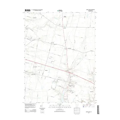
2013 Map of Mount Orab
USGS Topo · Published 2013About this map
Mount Orab serves as the focal point of this Brown County landscape, where the confluence of modern thoroughfares like Oh-32 and Us-68 meet established local routes. The area is characterized by a network of small settlements and agricultural crossroads, including Fivemile, Greenbush, and Bodman. These communities are often anchored by local heritage sites such as Taylors Chapel Cem and Greenbush Cem, providing a clear record of early family names and settlement patterns. The terrain is defined by a series of south-flowing waterways, most notably Sterling Run, Todd Run, and Indian Camp Run, which carve through the land before reaching Grant Lake. Aviation interests are represented by local facilities like Neals Airport and Bernie's Airport, while the periphery of the map preserves smaller, named locales like Stringtown and White Oak that reflect the region's enduring rural character.
Find a feature on this map
105 named features on this map. Tap any name to fly to it.
Don’t see what you’re looking for? This feature index may not catch every label — zoom into the map to look around manually.
Map Details
Editions of this 2013 Mount Orab Map
This is the sole edition of this map. No revisions or reprints were ever made.
Other maps of this area

1914 · Batavia
USGS Topo · 1:48,000

1916 · Batavia
USGS Topo · 1:62,500

1917 · Sardinia
USGS Topo · 1:62,500

1928 · Higginsport
USGS Topo · 1:48,000

1931 · Felicity
USGS Topo · 1:62,500

1931 · Higginsport
USGS Topo · 1:62,500

1944 · Sardinia
USGS Topo · 1:62,500

1947 · Columbus
USGS Topo · 1:250,000

1953 · Bethel
USGS Topo · 1:24,000

1953 · Newtonsville
USGS Topo · 1:24,000