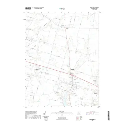
2019 Map of Mount Orab
USGS Topo · Published 2019About this map
Mount Orab serves as the central hub of this Brown County landscape, where the convergence of US Rte 68 and modern transport corridors anchors the local economy. The surrounding terrain is defined by a dense network of drainage, including Fivemile Cr, Sterling Run, and the winding Crane Run, all moving through a quilt of agricultural holdings. The map reveals a high concentration of burial sites that provide vital clues for genealogical research, such as Taylors Chapel Cem, Bloom Rose Cem, and Five Mile Cem near the small settlement of Fivemile. Recreation and infrastructure are evident at Grant Lake and the Mount Orab Reservoir, while smaller hamlets like Bodman, Eastwood, and Centerville dot the rural intersections, preserving the footprint of earlier community centers in southwest Ohio.
Find a feature on this map
112 named features on this map. Tap any name to fly to it.
Don’t see what you’re looking for? This feature index may not catch every label — zoom into the map to look around manually.
Map Details
Editions of this 2019 Mount Orab Map
This is the sole edition of this map. No revisions or reprints were ever made.
Other maps of this area

1914 · Batavia
USGS Topo · 1:48,000

1916 · Batavia
USGS Topo · 1:62,500

1917 · Sardinia
USGS Topo · 1:62,500

1928 · Higginsport
USGS Topo · 1:48,000

1931 · Felicity
USGS Topo · 1:62,500

1931 · Higginsport
USGS Topo · 1:62,500

1944 · Sardinia
USGS Topo · 1:62,500

1947 · Columbus
USGS Topo · 1:250,000

1953 · Bethel
USGS Topo · 1:24,000

1953 · Newtonsville
USGS Topo · 1:24,000