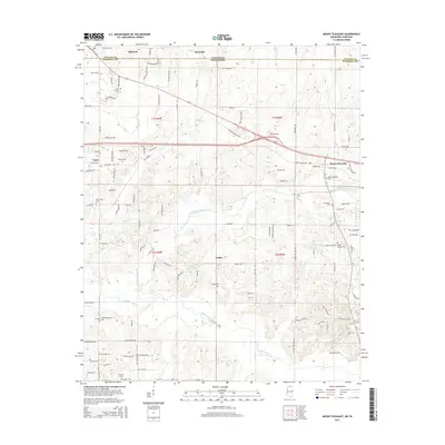
2015 Map of Mount Pleasant
USGS Topo · Published 2015About this map
Piperton and Rossville sit along the northern edge of this landscape, where the Tennessee state line meets Mississippi. The terrain is defined by the drainage systems of the Coldwater River and Little Coldwater Creek, which wind through the southern half of the quadrangle. Significant rural development is evident near Mount Pleasant, where local history is preserved in sites like the Mount Pleasant Cem and Carey Chapel Cem. The map illustrates a transitional landscape where established crossroads like Taska and Cayce connect via a network of rural roads such as Norfolk Southern Way and Kings Mountain Rd. This 2015 survey provides a clear view of the modern residential footprints and agricultural boundaries that characterize the borderlands between Fayette and Marshall counties.
Find a feature on this map
118 named features on this map. Tap any name to fly to it.
Don’t see what you’re looking for? This feature index may not catch every label — zoom into the map to look around manually.
Map Details
Editions of this 2015 Mount Pleasant Map
This is the sole edition of this map. No revisions or reprints were ever made.
Other maps of this area

1943 · Collierville
USGS Topo · 1:62,500

1948 · Byhalia
USGS Topo · 1:62,500

1949 · Moscow
USGS Topo · 1:62,500

1953 · Holly Springs
USGS Topo · 1:62,500

1953 · Collierville
USGS Topo · 1:50,000

1956 · Blytheville
USGS Topo · 1:250,000

1956 · Tupelo
USGS Topo · 1:250,000

1958 · Tupelo
USGS Topo · 1:250,000

1959 · Blytheville
USGS Topo · 1:250,000

1965 · Rossville
USGS Topo · 1:24,000