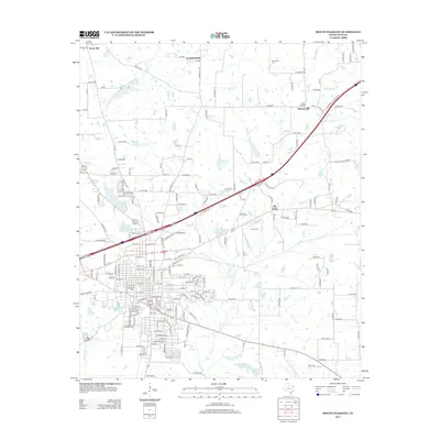
2013 Map of Mount Pleasant
USGS Topo · Published 2013About this map
New City Lake and Old City Lake serve as focal points for the expanding residential developments of Devonshire and Country Club Drive in this 2013 record of the Mount Pleasant area. The landscape shows a blend of dense urban street grids and the rural heritage of Northeast Texas, evidenced by several outlying burial grounds like Roundtree Cem and Liberty Hill Cem.
Find a feature on this map
201 named features on this map. Tap any name to fly to it.
Don’t see what you’re looking for? This feature index may not catch every label — zoom into the map to look around manually.
Map Details
Editions of this 2013 Mount Pleasant Map
This is the sole edition of this map. No revisions or reprints were ever made.
Other maps of this area

1953 · Texarkana
USGS Topo · 1:250,000

1956 · Texarkana
USGS Topo · 1:250,000

1964 · Harvard
USGS Topo · 1:24,000

1964 · Wilkinson
USGS Topo · 1:24,000

1964 · Talco
USGS Topo · 1:24,000

1964 · Cason
USGS Topo · 1:24,000

1965 · Winfield
USGS Topo · 1:24,000

1965 · Monticello
USGS Topo · 1:24,000

1965 · Mount Pleasant
USGS Topo · 1:24,000
1965 · Cookville
USGS Topo · 1:24,000