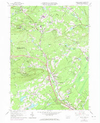
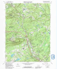
1966 Map of Mount Pocono
USGS Topo · Published 1974About this map
Big Pocono State Park and the high ridges of Camelback Mountain define this mid-1960s landscape, which shows the region's transition into a recreation and transportation hub. The Erie-Lackawanna railroad traverses the northern corridor through Mount Pocono, while the development of modern interchanges at Scotrun and Tannersville signals the growing importance of highway access for the area's resorts and residential enclaves. Local institutions such as the Pocono Mountain Jr-Sr High Sch and Kirk in the Woods Ch anchor the community, alongside traditional landmarks like Pocono Manor and the Fish Hatchery in Paradise Valley. Notable geological and hydrological features including Huckleberry Swamp, Paradise Falls, and Mountain Spring Lake are documented in detail, illustrating the complex water network that supported both early industry and later tourism.
Find a feature on this map
83 named features on this map. Tap any name to fly to it.
Don’t see what you’re looking for? This feature index may not catch every label — zoom into the map to look around manually.
Map Details
Editions of this 1966 Mount Pocono Map
5 editions found
Other maps of this area

1891 · Delaware Water Gap
USGS Topo · 1:62,500

1893 · Delaware Water Gap
USGS Topo · 1:62,500

1914 · Wind Gap
USGS Topo · 1:62,500

1916 · Wind Gap
USGS Topo · 1:62,500

1919 · Pocono
USGS Topo · 1:62,500

1921 · Pocono
USGS Topo · 1:62,500

1923 · Pocono
USGS Topo · 1:62,500

1924 · Bushkill
USGS Topo · 1:48,000

1936 · Delaware Water Gap
USGS Topo · 1:48,000

1941 · Delaware Water Gap
USGS Topo · 1:62,500
Featured Places
- Mount Pocono, PA
- Paradise Township, PA
- Bartonsville, Pocono Township
- Pocono Township, PA
- Swiftwater, Pocono Township