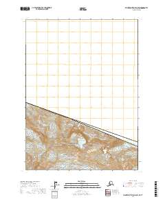
2017 Map of Mount Saint Elias B-8 SW
USGS Topo · Published 2017About this map
Mt Saint Elias dominates this high-altitude landscape along the international boundary where the Canada-United States border cuts across the massive ice fields of the Saint Elias Mountains. This survey captures the frozen geometry of the Wrangell-Saint Elias National Park, focusing on the confluence of the Tyndall Glacier and the Agassiz Glacier. The terrain is characterized by extreme elevation changes, rising from the glacial basins toward the summit of Haydon Peak. This map serves as a precise record of the glacial extent and topographic contours in the Yakutat Borough during the early 21st century, illustrating how these immense ice flows carve the Alaskan landscape at one of its highest and most remote points.
Find a feature on this map
11 named features on this map. Tap any name to fly to it.
Don’t see what you’re looking for? This feature index may not catch every label — zoom into the map to look around manually.
Map Details
Editions of this 2017 Mount Saint Elias B-8 SW Map
This is the sole edition of this map. No revisions or reprints were ever made.
Other maps of this area

1950 · Bering Glacier
USGS Topo · 1:250,000

1951 · Bering Glacier
USGS Topo · 1:250,000

1951 · Mt Saint Elias
USGS Topo · 1:250,000

1959 · Bering Glacier
USGS Topo · 1:250,000

1959 · Mt Saint Elias
USGS Topo · 1:250,000
1985 · Bering Glacier B-1
USGS Topo · 1:63,360
1985 · Mount Saint Elias A-8
USGS Topo · 1:63,360
1985 · Mount Saint Elias B-8
USGS Topo · 1:63,360
1985 · Bering Glacier A-1
USGS Topo · 1:63,360
2017 · Bering Glacier A-1 NE
USGS Topo · 1:25,000