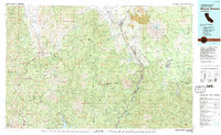
1979 Map of Mount Shasta
USGS Topo · Published 1992About this map
Mount Shasta dominates this northern California landscape, its massive volcanic profile surrounded by a complex network of canyons and high ridges in the late 1970s. The Southern Pacific railroad follows the winding corridor of the Sacramento River, passing through the communities of Dunsmuir, Shasta Springs, and Shasta Retreat. This corridor was essential for the timber and transit industries of the era, linking the mountain's base to the valley below. To the west, the steep peaks of the Trinity Mountains and the Scott Mountains offer a stark contrast to the volcanic debris of the Lava Natural Landmark to the northeast. Researchers can find historical resource extraction sites like the Integral Mine and Mumbo Mine, while the distinctive granite spires of Castle Crags stand as a permanent landmark above the river valley.
Find a feature on this map
87 named features on this map. Tap any name to fly to it.
Don’t see what you’re looking for? This feature index may not catch every label — zoom into the map to look around manually.
Map Details
Editions of this 1979 Mount Shasta Map
3 editions found
Other maps of this area

1886 · Lassen Peak
USGS Topo · 1:250,000

1886 · Modoc Lava Bed
USGS Topo · 1:250,000

1886 · Shasta
USGS Topo · 1:250,000

1890 · Red Bluff
USGS Topo · 1:250,000

1892 · Modoc Lava-Bed
USGS Topo · 1:250,000

1892 · Lassen Peak
USGS Topo · 1:250,000

1894 · Lassen Peak
USGS Topo · 1:250,000

1894 · Red Bluff
USGS Topo · 1:250,000

1894 · Shasta
USGS Topo · 1:250,000

1901 · Redding
USGS Topo · 1:125,000