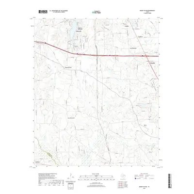
2019 Map of Mount Sylvan
USGS Topo · Published 2019About this map
The gated community of Hideaway and the adjacent Hide-A-Way Lake anchor the northwest corner of this Smith County landscape, characterized by modern residential developments alongside older rural settlements. The terrain is defined by a dendritic network of creeks including Prairie Cr, Long Brake Cr, and Chinquapin Cr, which feed several small reservoirs like House Lake and Swan Lake. Near the junction of Interstate 20 and Highway 110, the historic community of Mount Sylvan sits in contrast to the expanding outskirts of Tyler to the southeast. Genealogists will find several small burial grounds documented, such as Hill Cem near the Van Zandt County line and Sitton Cem further east. Aviation history is represented by the Walk-Air Airport near New Harmony, while the presence of Thedford and Wood Springs illustrates the persistent footprint of small, unincorporated communities in the East Texas piney woods.
Find a feature on this map
102 named features on this map. Tap any name to fly to it.
Don’t see what you’re looking for? This feature index may not catch every label — zoom into the map to look around manually.
Map Details
Editions of this 2019 Mount Sylvan Map
This is the sole edition of this map. No revisions or reprints were ever made.
Other maps of this area

1948 · Tyler
USGS Topo · 1:62,500

1948 · Brownsboro
USGS Topo · 1:62,500

1949 · Tyler
USGS Topo · 1:62,500

1949 · Brownsboro
USGS Topo · 1:62,500

1956 · Tyler
USGS Topo · 1:250,000

1959 · Van Lake
USGS Topo · 1:24,000

1959 · Grand Saline
USGS Topo · 1:62,500

1960 · Lindale
USGS Topo · 1:24,000

1960 · Crow
USGS Topo · 1:24,000

1966 · Chandler
USGS Topo · 1:24,000